
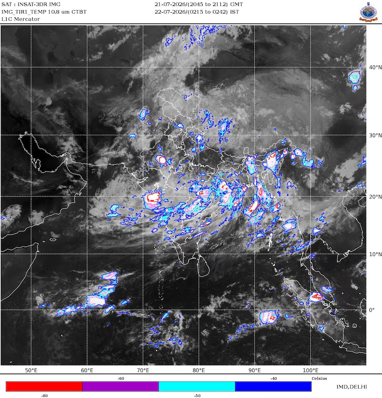


While most of the country slept around 3 a.m. on July 22, an ISRO INSAT satellite positioned 36,000 km above the equator captured a striking image: nearly 95% of the Indian subcontinent blanketed by a massive sheet of monsoon clouds. Combined with data on the monsoon trough, cloud top temperatures, and the latest IMD bulletin, these images give forecasters a clear picture of the upcoming rain.
What the INSAT Satellite Imagery Reveals
- Soaring Storm Clouds: The data indicates towering thunderstorm tops that have climbed up to 16 km into the atmosphere.
- Nighttime Thermal Mapping: The satellite utilizes a thermal infrared frame, which records heat signatures rather than visible light. This technology allows meteorologists to capture detailed weather patterns in complete darkness.
- The Cloud Trajectory: A massive, curved band of clouds is shown sweeping from the northern Bay of Bengal, crossing over Odisha, Chhattisgarh, and Madhya Pradesh, before stretching out toward Gujarat and the Arabian Sea.
- The Dry Gaps: Amidst this near-total coverage, the only major areas remaining clear of the weather band are Kutch and Western Rajasthan.


 By
By